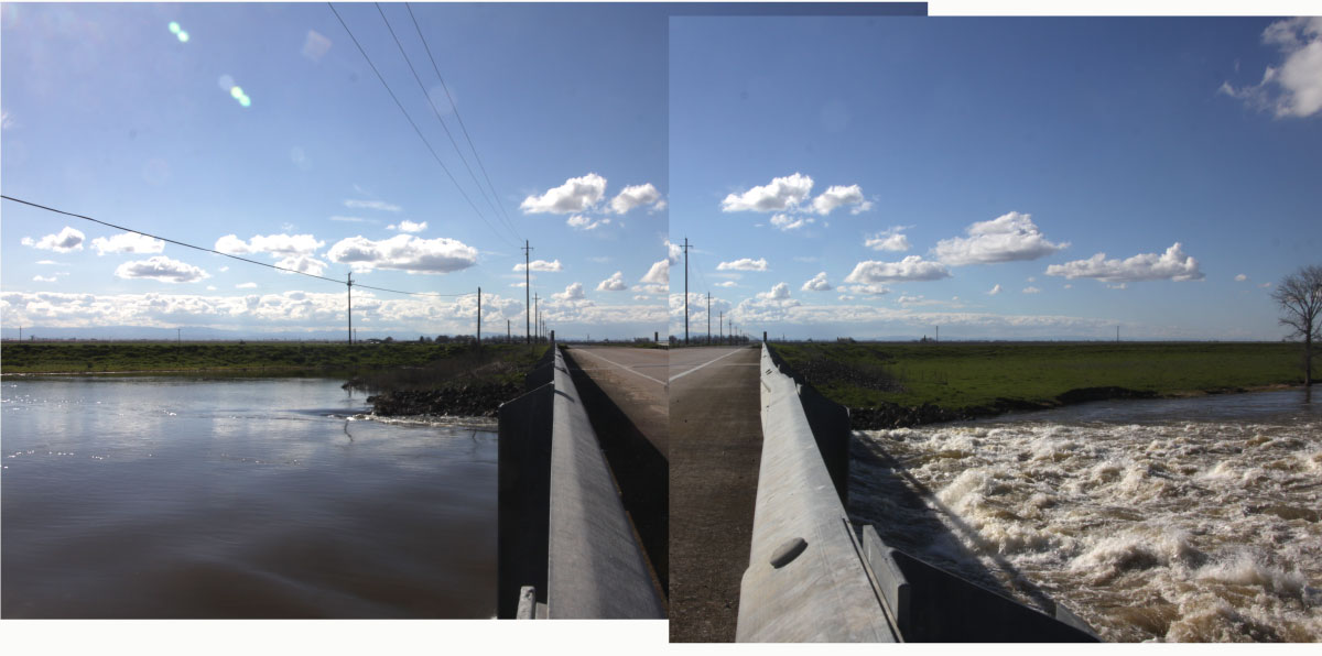
Troubled Water A flow of runoff designed to move serenely through a bypass structure becomes an abrasive torrent, right, after pouring down a waterfall created by land subsidence. To rejoin the San Joaquin River, this water will have be pumped back out again or a growing pool of low-level water may spill out over nearby land. Photos: Alan Propp, Bill Lane Center for the American West
The story of land subsidence in California’s Central Valley usually begins with a focus on wells and groundwater withdrawal. So, in western Madera County, one looks to wells like the ones Case Vlot needed to keep forage growing on his 3,500 acres in Chowchilla, which he uses to feed a few thousand dairy cattle. As the San Francisco Chronicle reported, 10 of Vlot’s wells reach below the clay layer deep underground that supports the gently sloping farmland from Los Banos to Madera.
That farmland has been cracking at the surface for years; heavy pumping to keep crops alive during a five-year drought has made it worse. But now that the rains have come back with a vengeance, water managers have a new reality: like the topsoil, structures built 40 years ago to contain floodwaters are cracking, too. Thanks to the damage, they can’t hold as much water.
It is not a good time for the flood infrastructure to function below capacity. Just as the drought was epic, the snowmelt of 2017, arriving in the next few months, may be epic as well. So, three things are happening:
- Downstream, Central Valley farmers, water managers, and communities are getting ready for the water’s arrival.
- Upstream, dam managers are trying to make room in their reservoirs to store the coming snowmelt, hoping they can make enough space to allow them to release runoff gradually into the rivers below.
- Overhead, aircraft and satellites are providing increasingly accurate measurements of how much the land below has subsided. Water specialists and researchers are analyzing the this data to determine what is happening, where, how fast, and what must be done about it.
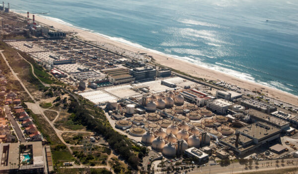
One of the starkest examples of subsidence in California’s Central Valley can be found in the area around Los Banos and Chowchilla, where the 50-mile Chowchilla-East Side Bypass structure was designed to absorb the runoff from the San Joaquin River and its tributaries. But it is hardly unique in being damaged by subsidence, according to a recent report from NASA’s Jet Propulsion Laboratory.
Last month, the agency reported the sinking is happening faster, putting infrastructure on the surface at growing risk of damage. In a bowl north of Yolo, the ground has dropped nine inches over the past six years; a bowl around Tulare and Corcoran has subsided a like amount, or even a bit more. A new book, “High and Dry,” explains that the subsidence the San Joaquin Valley is suffering mirrors what is happening in arid farming regions around the world.
The measuring tools carried by aircraft and satellites have become very sophisticated. “We have radar images every six days to a month, repeating,” said Tom Farr, a scientist at the Jet Propulsion Laboratory who is the lead author of the NASA report, “I can see the changes in the ground as they happen.” Not all the subsidence is permanent, he added.
And it is not just flood control structures whose capacity has been reduced by subsidence. A new paper by Rosemary Knight, an Earth Sciences professor at Stanford and Ryan G. Smith, a Stanford Ph.D. candidate in environmental geophysics, which was published in “Water Resource Research,” determined that subsidence caused a permanent loss of groundwater storage capacity amounting to “roughly nine percent of the groundwater pumping” in the Central Valley area they studied.

“Whatever happens below the ground, it’s done. You cannot recover.” Chris White of the Central California Irrigation District. At right, water cascades down a rift created by subsidence under a bridge over the Chowchilla Bypass. Managers estimate that damage caused by subsidence has reduced the canal’s carrying capacity by a quarter. Photos: Alan Propp, Bill Lane Center for the American West
As far as Chris White is concerned, “Whatever happens below the ground, it’s done. You cannot recover.” Mr. White is the general manager of the 80-mile long Central California Irrigation District, which encompasses are quarter of a million acres and 1,900 landowners in the area around Los Banos. The district supplies more than half a million acre-feet of water a year to its largely agricultural customers. Mr. White knows very well what farmers have gone through trying to keep crops going during droughts. He also remembers the flood years, like 1997 — experience that is guiding him now.
Standing on a bridge over the Chowchilla Bypass, he gestures past the water roaring over a 15-foot waterfall created by subsidence, to a spot beyond where surging water from a February storm overtopped the banks and left a tangle of tree limbs and other debris. Aside from endangering farmland, the floods that could overtop the bypass could swamp parts of Highway 152 and a local elementary school.
Perched over the new waterfall, Mr. White explained the gouging impact of the water, which makes the hole deeper. The water carries away soil and vegetation, depositing them further down the bypass in a low place with slower flow. This further impedes water designed to flow back into the San Joaquin riverbed. Worse, subsidence means the water pools lower than the last portion of the bypass structure. To get the water back into the bypass and on to the river channel, it must be pumped uphill.
Sunken by Groundwater Pumping, the Central Valley’s Flood Infrastructure Will Be Put to the Test By Spring Snowmelt
During the past few years of drought, large parts of California’s Central Valley experienced land subsidence — a sinking of the ground level that can damage infrastructure and affect the flow of irrigation and stormwater canals. The primary culprit, researchers at NASA’s Jet Propulsion Laboratory believe, is the heavy pumping of groundwater to replace missing surface water supply. According to NASA’s aerial analyses, some areas of the Central Valley sank more than two feet between the springs of 2015 and 2016. Subsidence threatens a vast range of elevation-sensitive infrastructure (in addition to canals and levees), such as railroads, bridges, and buildings. At right, an animation of the estimated snowpack in the Sierra Nevada mountains over the past few months; this spring, water managers expect snowmelt to bring intense runoff into the Central Valley.

Avoiding a flood of water that overtops the bypass is the job of people like Michael Wolfe, a hydrologic supervisor at the Friant Dam, which impounds San Joaquin River water several miles away. Right now, Mr. Wolfe said, dam managers from the federal Bureau of Reclamation are releasing water at an unusually high rate of 9,000 cubic feet per second, to lower the level of the reservoir and allow more space for the snowmelt. “We don’t know when it’s going to come and we’re being as ready as we possibly can be,” he said. One can get ahead of a deluge; it’s almost impossible to catch up.
When the snowmelt comes, the managers at Friant will be having frequent conference calls with their counterparts at the Army Corps of Engineers, who manage dams: the Buchanan dam on the Chowchilla River; the Hidden Dam on the Fresno River just south of it; and further south, the Pine Flat Dam on the Kings River. Also on the calls is the state’s Department of Water Resources, which manages smaller structures.
“When it gets going hot and heavy, we talk every day,” Mr. Wolfe said, “it’s been a good a start to the flood season because we’ve run flood control flows since January,” indicating that the high-volume releases to date are keeping dam managers with capacity to spare to accommodate some future floods. The managers also talk to the San Joaquin Levee District, which manages the bypass. All of them try to do the math, juggling variables of time, distance and flow, to make sure that the vulnerable sections of the bypass don’t have to absorb more than 12,000 cubic feet per second of water. Before subsidence, that section was designed to accommodate 16,500 cfs.
But the dam managers have floods of their own to avoid, and a prescribed regimen of releases when waters surge; their needs take precedence, in a pinch. In the coming weeks, it will be evident whether their choreography of the 2017 water ballet can keep the Los Banos and Madera area dry.
Read Next in …& the West

Beyond the Coal Boom: Powder River Basin Residents Look to a Diversified Future
The nationwide decline of coal is testing the resilience of the Powder River Basin. Residents used to a thriving economy, a top-notch education system, and an excess of job opportunities are learning to live with less.

Efforts to preserve California’s groundwater enter a new phase: a season of judgement
Architects of the 2014 Sustainable Groundwater Management Act tried to forestall conflict between state regulators and local groundwater users. But judging plans “inadequate” creates hard-to-reconcile differences.
In times of scarcity, California’s best new source of water? Reuse.
While expensive solutions like new reservoirs and seawater desalination grab attention, California communities are quietly building up their capacity to clean stormwater and wastewater for reuse for irrigation, industry and, yes, drinking water too.
A simmering revolt against groundwater cutbacks in California
New agencies find making sustainability plans is hard, but easier than persuading growers to accept them.

California Water on the Market: Q&A with Barton “Buzz” Thompson
Three months after the first market trades of California water futures, a conversation about economic forces and an essential material for life.

Small Farmers Wait for California’s Groundwater Hammer to Fall
Farmers, large and small, are beginning to grapple with what the Sustainable Groundwater Management Act means for them. Many expect to see cutbacks on pumping once the program is fully implemented in 2040.

Putting a Tempest into a Teapot: Can California Better Use Winter Storms to Refill its Aquifers?
With new rules coming into effect, farmers and municipalities using groundwater must either find more water to support the aquifers or take cropland out of use. To ease the pain, engineers are looking to harness an unconventional and unwieldy source of water: the torrential storms that sometimes blast across the Pacific Ocean and soak California.

As California’s Groundwater Free-for-All Ends, Gauging What’s Left
New rules and new technology are giving farmers and managers a better look at groundwater supplies.

To Save Crops, Farmers Took Groundwater. Then the Land Sank
Like the topsoil, structures built 40 years ago to contain floodwaters are cracking, too.

To Manage Groundwater, California Must First Get Basin Boundaries Right
A vineyard in Paso Robles. Mattyshack via Flickr By Felicity Barringer A hidden treasure, groundwater has long sustained agriculture through California’s cycles of drought. Decades