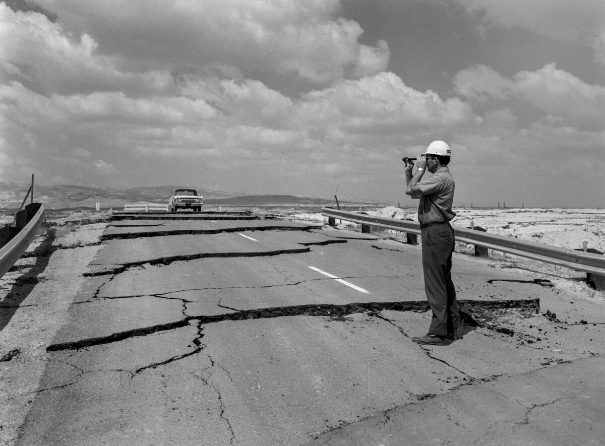
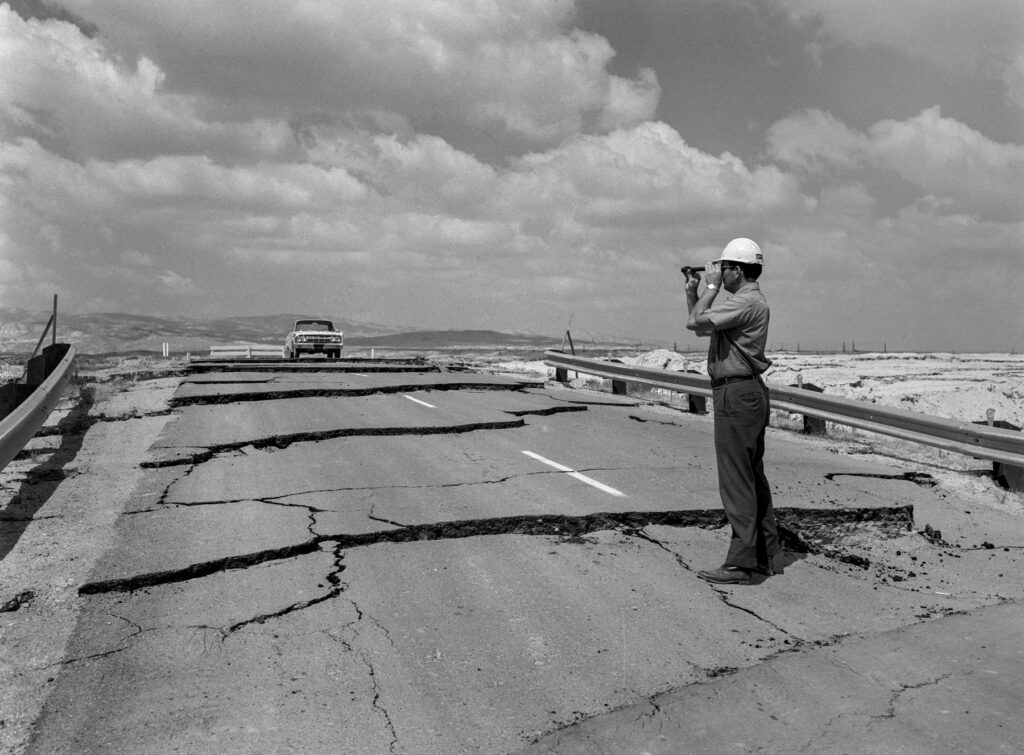
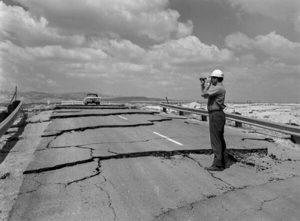
A solved problem roars back In April 1966, a California Department of Water Resources field engineer examined cracks caused by subsidence, on a closed roadway near Taft in Kern County. Vince Arrant / California Department of Water Resources
Of all the risks farmers face in the San Joaquin Valley – floods, droughts, fluctuating commodity prices, labor and its costs – one now dominates their lives. The very land they work is sinking beneath their feet. This phenomenon, known as subsidence, threatens agricultural and other infrastructure and incurs staggering repair costs.
Subsidence has been an ongoing drama in two acts.
The first act of sinking took place in the mid-20th century, when aggressive groundwater pumping lowered aquifers and, in many areas, the land lying above them. It abated in the early 1970s when surface water from major river systems – the Sacramento and the San Joaquin – flowed downhill scores or even hundreds of miles to San Joaquin Valley farms through new aqueducts and canals.
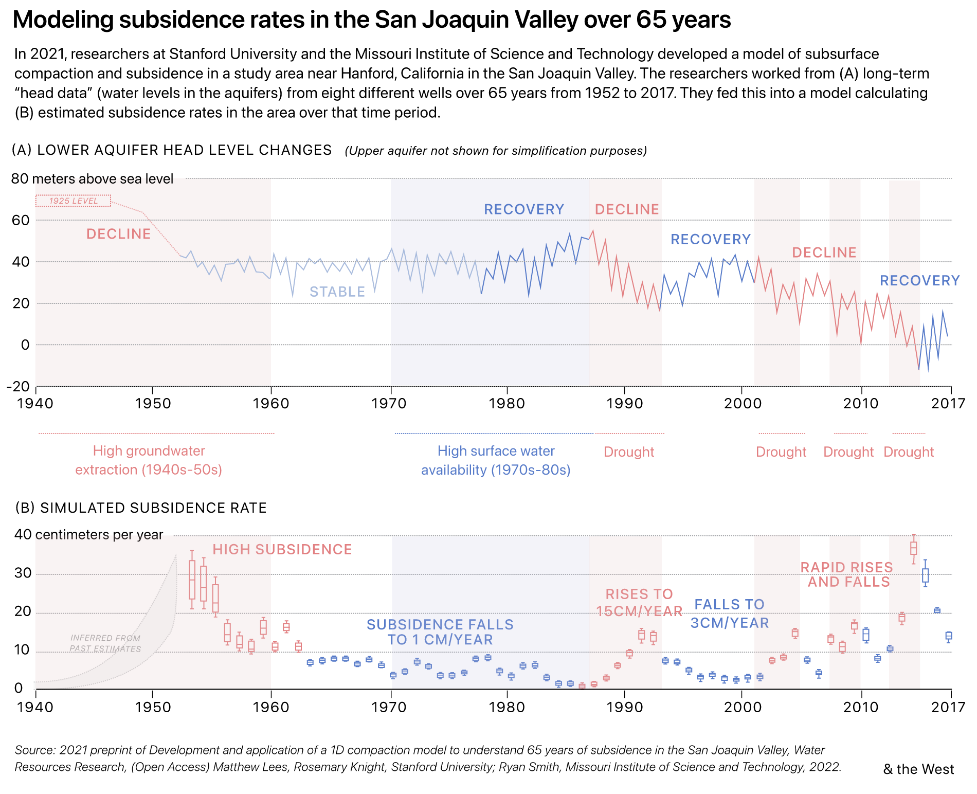
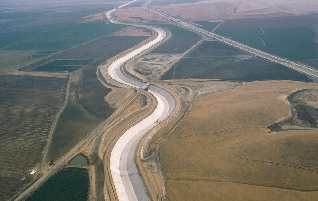
The water deliveries ended subsidence’s first act. The second act began three decades later around the turn of the millennium. Water sent into those aqueducts and canals can no longer be counted on to flow downhill; some sections were deformed as the land fell away and water pooled in new gulches, limiting deliveries. The second act won’t end until farmers sharply cut back on pumping.
“Subsidence is the most important [thing] because it is the driving force behind everything, really,” said Michael Knight, who now heads the Porterville Irrigation District GSA, a sustainability agency created last year. The sinking land around the valley, particularly in the southeast region around Corcoran, Delano, and Porterville, is changing decisions about what, where, and whether to farm.
Subsidence notwithstanding, Vincent Sola is one of those who won’t give up. “Farming’s just very volatile,” he said. “You’ve got to love it to do it. You’ve got to have some steel nerves because there’s a lot of unknowns.” Sola farms almonds, pistachios, corn, and cotton in Tipton, a town of perhaps 3,000. His eye is keen enough to detect changes in his land. “The grades of our own fields have changed a little bit. We flood irrigate. The water just changes – you can see it. The water tells you everything about the level.”
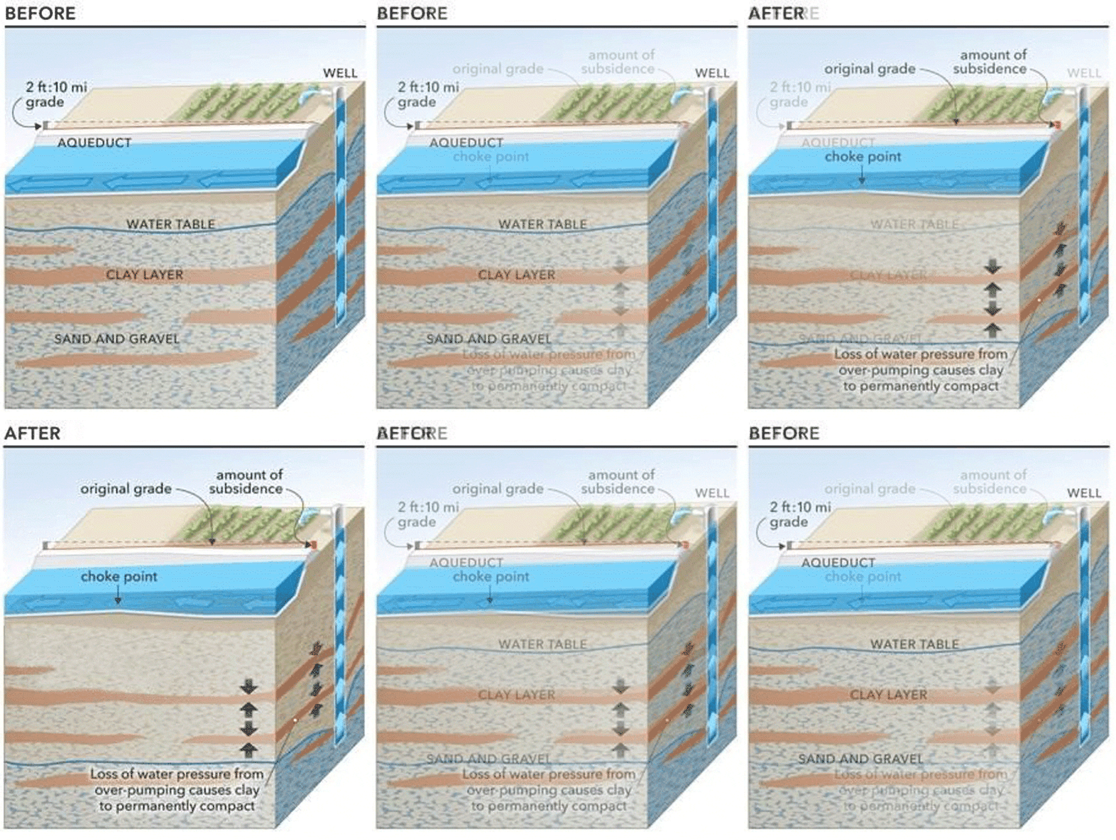
The subtle changes Sola can see in his fields are not at all subtle when it comes to the canals, pipelines and aqueducts built decades ago to carry water to farmers far from the Sacramento and San Joaquin rivers; thanks to subsidence, the biggest, the 444-mile California Aqueduct now carries far less. Or when it comes to flood protection: some levees that once held back floodwaters have sunk too far to do their jobs. Or the speed at which efforts to remedy the impact are themselves undone by more subsidence.
An iconic view of subsidence
Joseph Poland, pictured in this 1977 USGS photo, wrote, “Subsidence in the San Joaquin Valley probably represents history’s greatest single manmade alteration in the configuration of the earth’s surface.” Poland was a USGS scientist in 1984 when he co-authored a report containing that assessment.
Photo: US Geological Survey
An iconic view of subsidence
Joseph Poland, pictured in this 1977 USGS photo, wrote, “Subsidence in the San Joaquin Valley probably represents history’s greatest single manmade alteration in the configuration of the earth’s surface.” Poland was a USGS scientist in 1984 when he co-authored a report containing that assessment.
US Geological Survey
Documenting a resurgence
Decades later in 2017, USGS scientists, while touring the state for benchmark subsidence readings, reproduced the Poland photo at a different site off of California State Highway 15.
Justin Brandt/USGS
Documenting a resurgence
Decades later in 2017, USGS scientists, while touring the state for benchmark subsidence readings, reproduced the Poland photo at a different site off of California State Highway 15.
Justin Brandt/USGS
“Right now, there’s a circular cycle of fixing damage from subsidence without stopping the cause,” said Paul Gosselin, the deputy director of Sustainable Groundwater Management at the California Department of Water Resources (DWR.) “We’ve spent well in excess of $1 billion just to keep pace with the damage and it’s not getting better.”
Subsidence has strained relations among farmers who disagree on which pumping – or whose – causes the problem, how to pay for repairs, and how to satisfy the various needs of the state and the owners and managers of the damaged canals.
What is the greater problem, Sola was asked: subsidence or controlling groundwater pumping to stop it? “That’s a good question,” he said. “I’d say they are tied. They are both very sensitive.”
New, old, or borrowed, an abundance of diagnostic tools
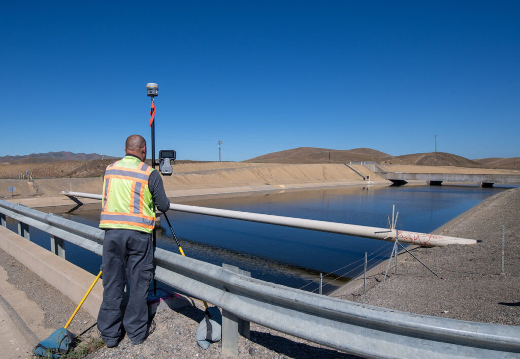
Land deformation, the bane of agriculture in one of the world’s farming meccas, can be seen through a variety of metrics. An expanding array of technical measuring devices – based in space, dangling from helicopters or drones, some using two forms of radar and still others inserted in the soil and some now being repurposed, like seismometers and telecommunication cables – can pinpoint, with increasing accuracy, where, how much, and how fast the land is sinking. “The tools and data that we have have grown enormously,” said Gosselin. “The cornerstone of monitoring is the InSAR satellite imagery” – a remote sensing technique using satellite radar imagery to measure millimeter-scale changes or deformation in surface elevation.
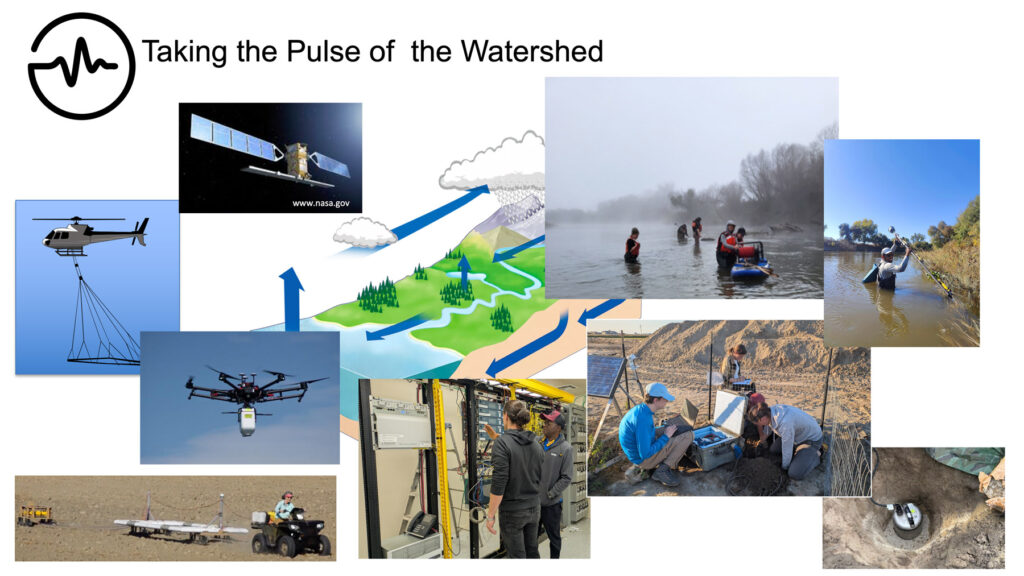
These devices can show whether or not the deformation is treatable.
Elastic subsidence means that introducing more water will allow sandy or gravelly soils to spring back, like a refilled sponge. Inelastic areas are those where layers of clay, interspersed with the gravel or sitting below it, irretrievably lose pockets of water within their pores. When they do, the clay layers collapse. Compaction is permanent.
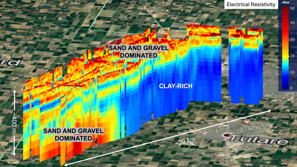
Over the past decade, Rosemary Knight, the Stanford geophysics professor and founder of the Center for Groundwater Evaluation and Management, has used such tools to produce intricate maps of the subsurface under the land of Sola and scores of other Tulare County farms, which shows the underground landscape within which subsidence happens.
The U.S. Geological Survey recently updated its hydrologic model, giving it a more accurate tool to determine how the system above and below ground responds to climatic variation and surface water availability. The new model, USGS reported in 2024, “estimates approximately 38 cubic miles of storage loss in the Central Valley from pre-development to 2019” – more than the entire volume of Lake Tahoe. It added, “About 15 percent … is permanent loss … from subsidence that has caused damage to roads, aqueducts, pipelines, levees and canals.”
A 2024 Nature paper by Knight and the Stanford PhD Michael Lees recounts the two chapters of subsidence in the Central Valley. As the first chapter was ending in about 1970, 4,247 square miles, roughly half the valley floor, had sunk by nearly a foot; some areas sank by as much as 28 feet, as the famous 1977 USGS photo (above) shows.
Abundant surface water held pumping-based subsidence at bay… for a time
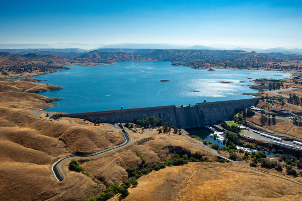
Starting in the mid-20th century, huge conveyance structures had begun to transfer river water to the San Joaquin Valley.
Surface water availability ended subsidence’s first act. Starting in the mid-20th century, huge conveyance structures had begun to transfer river water to the San Joaquin Valley. Two were completed in 1951: In the east, the 152-mile Friant-Kern Canal, taking water from the San Joaquin River and sending it to Tulare and Kern counties, was finished in 1951, and in the west, the 116-mile long Delta-Mendota Canal, taking water from the Sacramento-San Joaquin delta and sending it south to a holding pool 30 miles west of Fresno.
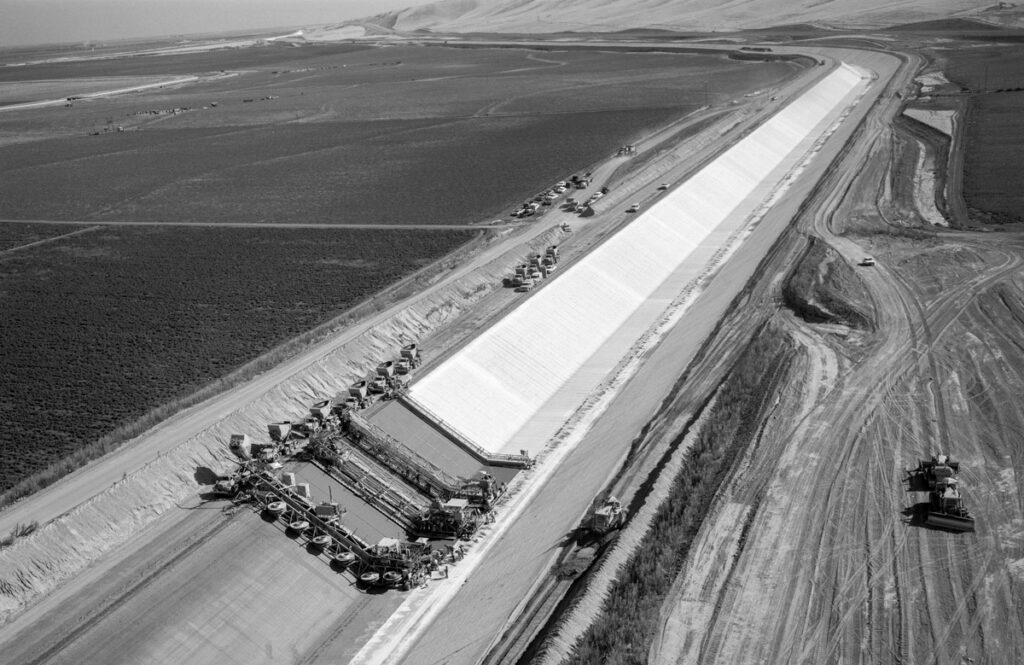
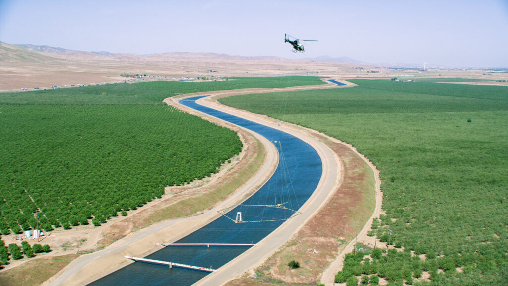
Completed about two decades later was the 444-mile California Aqueduct, delivering Sacramento River water to Kern and Kings counties but also to the central coast and, finally, to Los Angeles.
With abundant surface water, farmers’ need to pump groundwater diminished. Until 1992, that is, when federal laws, state rules and court decisions enforcing these measures meant tens of thousands of acre-feet of surface water was diverted to support fish and wildlife. These efforts – which, farmers complained, sent water they needed to the sea – meant their water deliveries dropped. For most of the past decade, deliveries were cut by at least 40 percent and often double that.
Farmers again turned to the ground. In the decades since the completion of the aqueduct, the last major water conveyance structure, an average of 300 to 500 wells were drilled annually.
Droughts and heavy groundwater pumping lead to renewed land subsidence – and new statewide rules
When the second chapter began in the mid-2000s, subsidence came back with a vengeance, breaking all previous records. During the next 15 years, three increasingly severe droughts hit the region. These bracketed the 2014 passage of the Sustainable Groundwater Management Act, or SGMA, the state’s effort to control groundwater overdrafts and to avoid their negative outcomes, including subsidence.
To get sufficient agricultural support for the legislation, it emphasized local control; state mandates would be a last resort. New “groundwater sustainability” agencies were formed with the authority to manage its use; existing irrigation districts often play critical roles in their governance. Some 32 of these new agencies used $187 million in state grants for technical assistance creating sustainability plans reflecting their unique geology and hydrology.
The plans were required to show how groundwater sustainability could be maintained by 2040, while avoiding the six negative consequences, subsidence among them.
New sustainability agencies in the Tulare County subbasins with the greatest overdrafts received up to $10 million in government funds for work on sustainability plans designed to reduce subsidence. The land controlled by these agencies either underlies or sits near the Friant-Kern canal, whose use was crippled by subsidence.
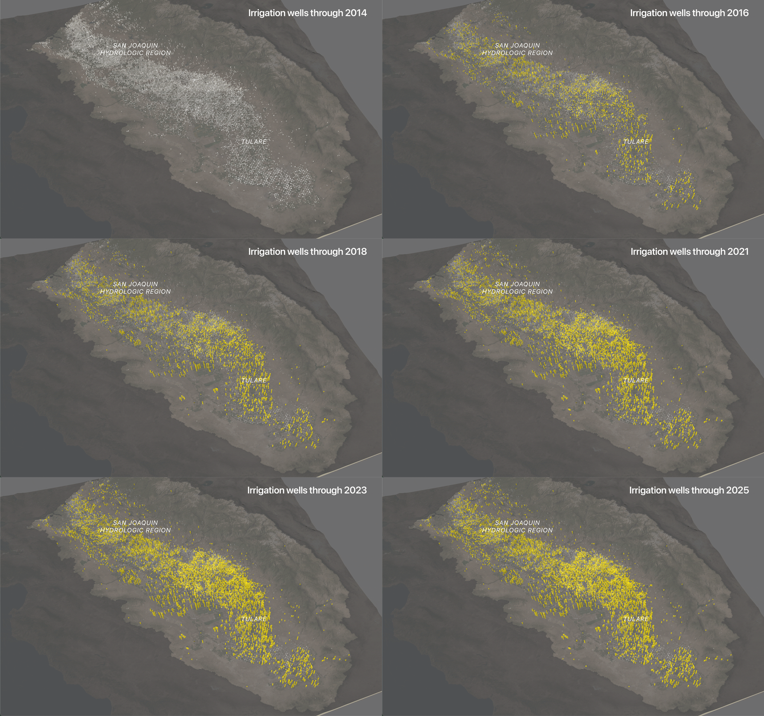
As the new agencies drafted sustainability plans, well drilling – accelerating the pumping linked to subsidence – was going crazy. The Sacramento Bee reported in 2016 that “Farmers dug about 2,500 wells in the San Joaquin Valley last year alone, the highest number on record. That was five times the annual average for the previous 30 years….”
In 2021, a Los Angeles Times investigation found that, in the seven years since the passage of SGMA, 6,200-plus agricultural wells were drilled. In 2021, 40 percent of all new Central Valley wells were drilled in Tulare County, which is now subsidence central.
A rush to drill in times of drought
Data from the state Department of Water Resources’ well completion records shows a sharp increase in new or modified agricultural wells in the San Joaquin and Tulare hydrological regions as severe drought conditions took hold in the mid 2010’s.
A 2017 NASA report showed that the ground around Corcoran, on the county’s western border, dropped by nearly two feet between May 2015 and September 2016. In 2023, a year of massive flooding in the Central Valley, Gosselin said, “we had to spend extra money to raise the Corcoran levee. The mitigation work done in 2018 had all but disappeared in 2023. There was four feet of subsidence.” The new expense: $17 million.
At the same time, the mid-20th-century conveyance facilities that relied on gravity found gravity working against them. The 152-mile Friant-Kern Canal carries San Joaquin River water from the Friant Dam near Fresno to the Kern River in Bakersfield. Decades of subsidence left a 33-mile stretch of the canal badly deformed; its capacity was reduced by 60 percent. Repairs made in the late 1970s proved worthless by July 2018. The canal was about 12 feet below its original elevation. Water pooled in low spots. Sinking bridges blocked flow.
In a 2019 interview with Irrigation Leader magazine, Jason Philips, the then-chief executive of the Friant Water Authority, said, “we estimate that 100,000–300,000 acre-feet of water—less in dry years and more in wet years—is not being delivered via the canal because of this capacity issue every year. The result, of course, is that 100,000–300,000 acre-feet more water is being pumped out of the ground every year instead, which is making the subsidence problem worse.”
While water supplies dwindled, agricultural production soared
The farmers’ changing decisions about what to plant hardened their demand for water. Uprooting orchards means losing a major capital investment.
Three Tulare County water agencies seemed to be at the epicenter of the sinking land.
So governing boards of the new sustainability agencies – mostly run by farmers in Tulare County – faced a crucial dilemma: owning the subsidence problem and paying for remedies, or arguing their pumping was just part of a basin-wide problem.
Groundwater was overdrafted in much of the county, particularly in areas with little access to surface water – what are called “white areas.” Many farmers in areas with surface water point to the farmers in white areas as the core of the problem; some of those farmers believed basin-wide pumping, not their wells, are largely responsible.
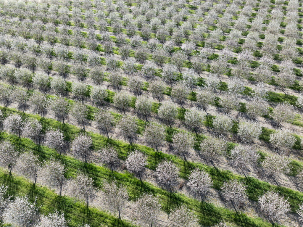
The farmers’ changing decisions about what to plant hardened their demand for water. There were incentives to replace crops like pasture, alfalfa and cotton with citrus, almond and pistachio orchards as the cost of federally-delivered water rose and subsidies for the row crops declined.
Federal water had been priced below $5 per acre for decades before the 1990’s. In that decade, a tiered set of increases sent the price to an average of $17 per acre foot. In some cases it climbed as high as $25 or more per acre foot. “What that did is change the ability of the growers to grow low-value row crops. Then high-value crops went in. We can’t afford to farm low-value crops with high-value water,” said one farmer.
Losing the row crops meant losing the ability to temporarily fallow land during droughts without losing more than a year’s income. But more and more farmers put in nut or citrus trees – higher-value crops. Uprooting orchards means losing a major capital investment.
As Jim Morehead, a 72-year-old almond farmer in the Pixley area, said, “when I was a teen or even in my first years of farming, you could drive from Porterville to Bakersfield and there was nothing but barley and oats. Dryland farming.” Now it’s all pistachios, citrus, and grapes. “That was marginal ground,” he said. New wells meant “you could take marginal ground and use it.”
Eric R. Quinley, who heads the Delano-Earlimart Irrigation District GSA, south of Morehead’s farm, agreed that in the 1980s and 1990s “lands that were never in production were put into production,” both in white areas and areas “that didn’t have anything close to a sufficient water supply.”
He continued, “as permanent plantings came in in unserved or underserved areas, it only hardened [water] demand. So the aquifer has been overtaxed for decades. That not only shows up in aquifer levels but in subsidence.”
Repairs are a temporary solution
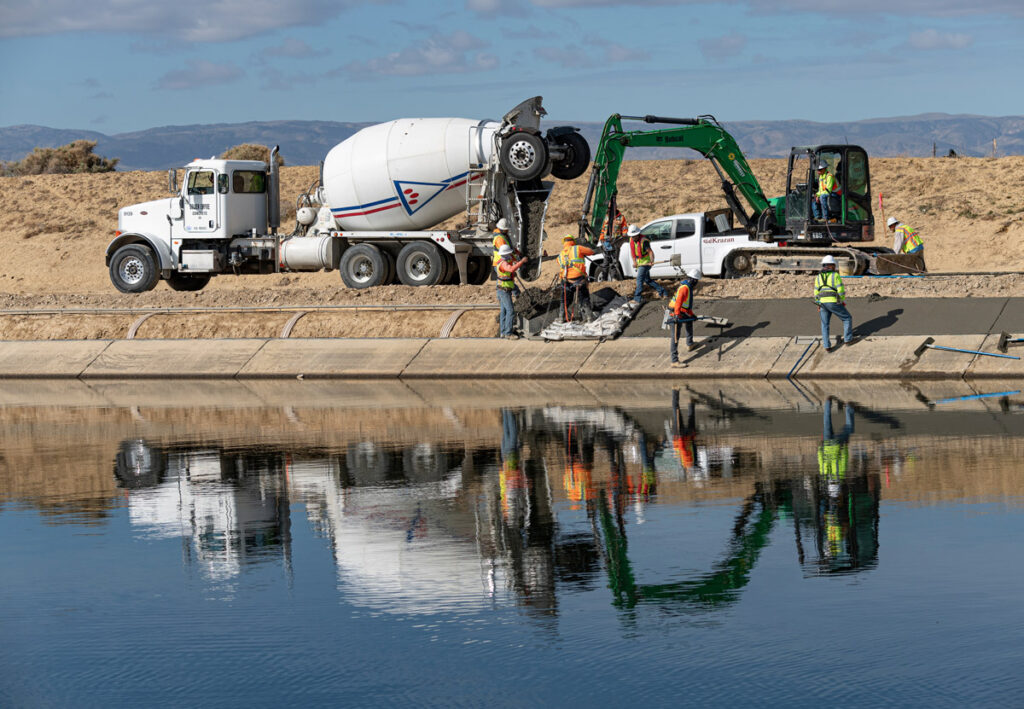
The costly deformation of the Friant-Kern Canal is not unique. The continued sinking of the Central Valley has caused problems in several locations, most notably creating at least five “bowls,” or concave structures along the length of the California Aqueduct, as Maven’s Notebook reported last year. The aqueduct’s carrying capacity is down by up to 46 percent in some places.
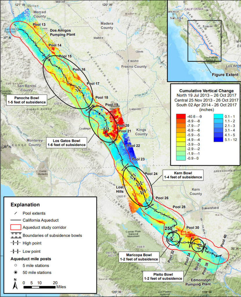
Repairing the damage to the aqueduct could cost as much as $3 billion or more. Some of the areas where pumping caused the greatest subsidence, like the Westlands Water District, have set up many areas where surface water can be recharged into the aquifer. The Fresno Bee reported that Westlands is on track to reach groundwater sustainability well ahead of the 2040 deadline set by SGMA.
Westlands has supervised the removal of hundreds of acres of orchards and moved aggressively on recharge projects. In an interview, Paul Gosselin of DWR said, “Even though a lot of areas where subsidence hasn’t been managed well – some agencies have taken strong action. Westlands made enormous progress.”
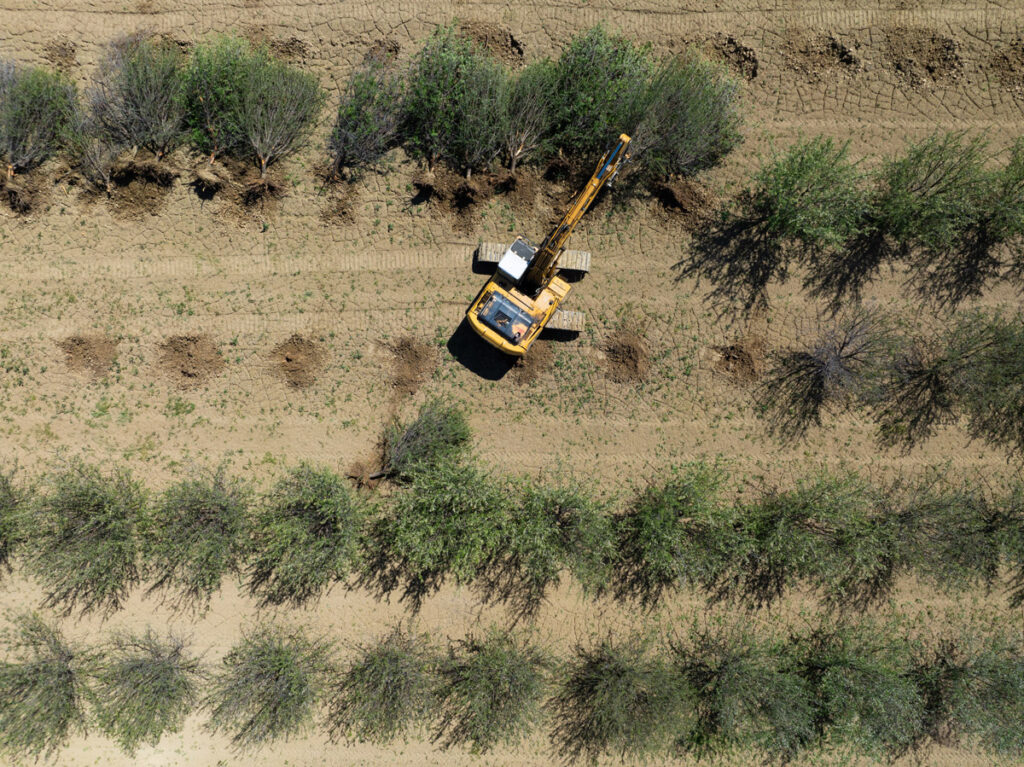
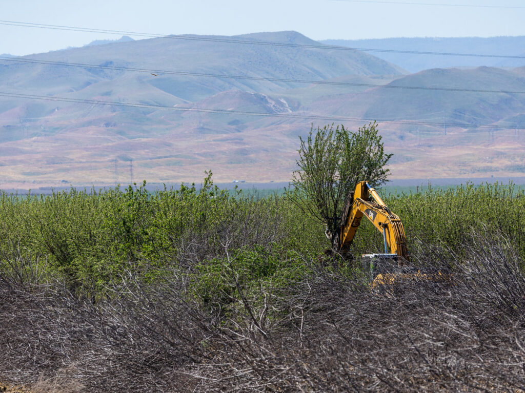
Westlands has supervised the removal of hundreds of acres of orchards and moved aggressively on recharge projects.
Executives of the groundwater sustainability agencies have been tasked with either finding new water and recharging aquifers or limiting pumping – called “demand management.” Both strategies help make aquifers sustainable, but farmers prefer recharge: limiting pumping means limiting crops and income. One farmer said “people say we have to fallow 500,000 acres – that’s worth $5 to $10 billion. … There’s no consideration of the ramifications for the top farming mecca in the entire world.”
For managers of sustainability agencies, DEID’s Quinley said, “It is challenging, there’s no doubt, to tell people things that are uncomfortable or they don’t want to hear.” But not doing so, he said, “does not serve them better. Folks would be better off – especially when large capital expenditures are contemplated – knowing the reality of the situation, and what risks to tolerate.”
Until recently, the water districts around the Friant-Kern Canal, whose plans for sustainability were found inadequate by state authorities, spent months going to court over who should take financial responsibility for the pumping responsible for subsidence. As Gosselin said, “We’re not looking at individual growers or placing blame on individuals. We look at – how the basin is carrying out responsibility to implement best management practices.”
The state’s rejection of sustainability plans automatically set farmer payments in motion: charges of $300 per well and $20 per acre-foot of water pumped.
Who is on the hook for repair costs?
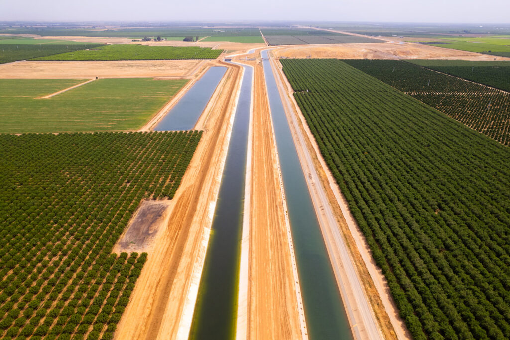
To repair the damage that compromised Friant deliveries, the Friant Water Authority decided to build a parallel canal duplicating the 33-mile damaged section.
The Eastern Tule Groundwater Sustainability Agency, whose 162,000 acres abut the Friant-Kern Canal, has been under a microscope for years. Questions were raised about whether its rules let farmers evade pumping limits and avoid fees. The state twice rejected ETGSA’s sustainability plans, deeming them inadequate to control subsidence. In October 2024, the state placed the entire Tule subbasin – 10 GSAs, Eastern Tule among them – on probation.
To repair the damage that compromised Friant deliveries, the Friant Water Authority decided to build a parallel canal duplicating the 33-mile damaged section. It released a report explaining the need. The first 10-mile stretch of that parallel canal was finished nearly two years ago, at a cost of $325 million. Some $206 million came from the federal Bureau of Reclamation, which expects the Friant Water Authority to reimburse it. The state Department of Water Resources said it would allocate another $39 million or so.
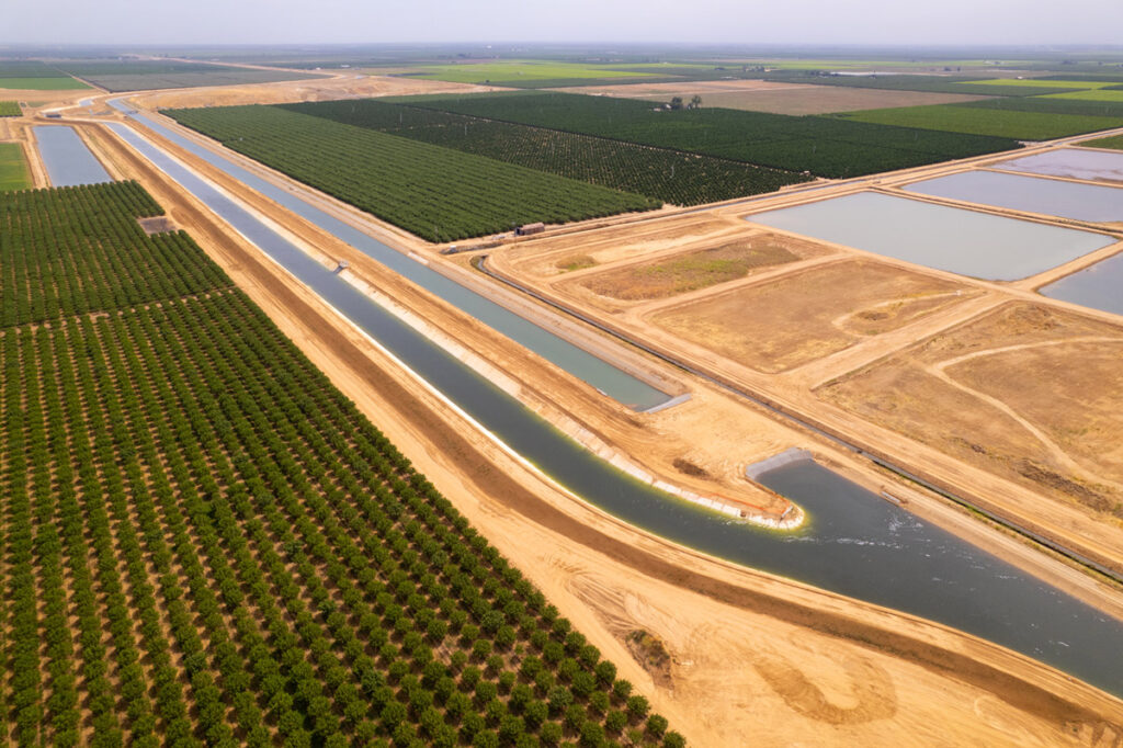
But tens of million dollars in other costs, for old debts and new fixes, remain. Who is on the hook? An agreement between ETGSA and Friant in 2021 fell apart in the last two years because the two sides disagreed on how much the sustainability agency had promised to contribute. In the intervening months, a rat’s nest of lawsuits were filed and the member GSAs once part of ETGSA fled to set up their own agencies and avoid financial liability.
These new agencies are writing their own plans to control pumping. One farmer who has multiple tracts of citrus-producing land around the canal, feels the creation of multiple agencies spreads responsibility for subsidence too thin. “As farmers we think local control is better,” he said, speaking on condition that he not be identified. “But we get [into] a situation where local entities are so small, so unskilled and so understaffed they don’t know what they are doing.”
Not all Tulare County agencies are in the same fix. Not far from this grower’s land is the Delano Earlimart Irrigation District GSA, which has access to considerable amounts of surface water. If an agency has taken effective steps to limit subsidence, the state can deem them “good actors” and not impose the penalties suffered by agencies put on probation. Two of the GSA’s in the Tule subbasin, including DEID, qualified as good actors.
This did not endear them to farmers in GSAs nearby; some have little good to say about DEID and Quinley.
Motions toward collective action
The settlement late last month and the abandonment of the tit-for-tat lawsuits lessened tension between the Friant Water Authority and the smaller agencies. The combatants, according to Friant’s statement, “agreed to resolve their pending litigation and to work collaboratively toward a new cost recovery methodology” to pay for fixing the canal, SJV Water reported.
The article quoted the board president of the Saucelito Irrigation District saying, “We put a policy we could not agree with aside and we are going to work very hard over the next year to replace it with something that is agreeable to everyone and not so divisive….” Still undecided is the apportionment of payments for canal repairs.
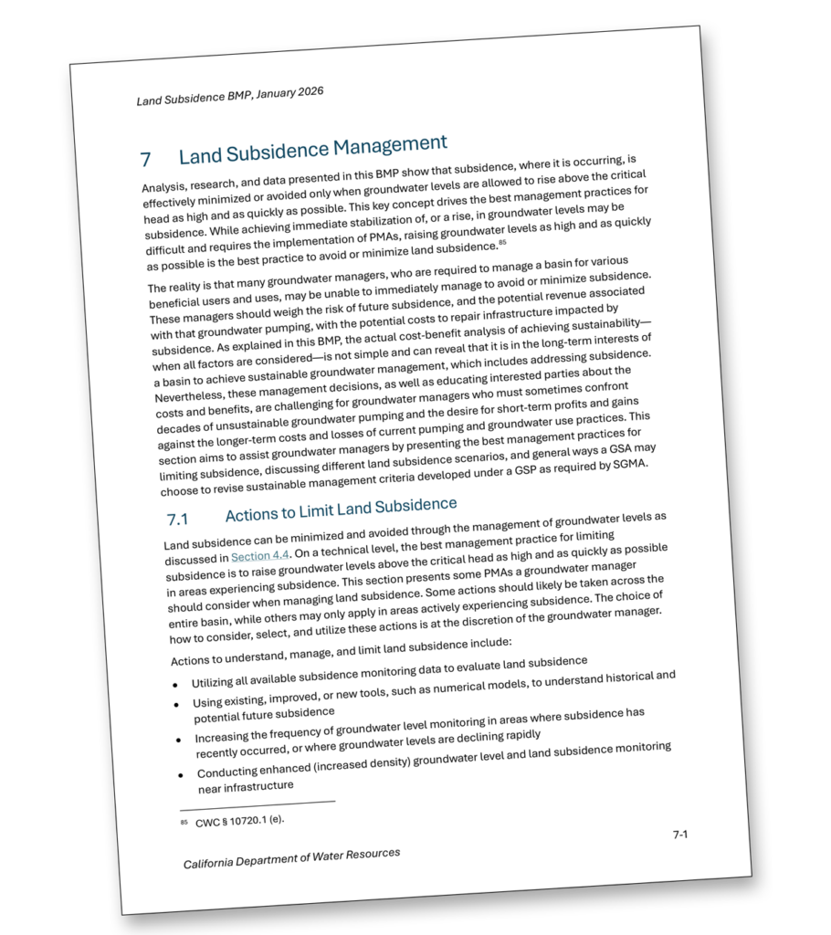
Controlling subsidence also means agreeing on metrics for groundwater consumption, appropriate aquifer levels and water use. As Gosselin said, “There were a lot of agencies out there that didn’t get the subsidence approach correct. A lot of agencies with new areas of subsidence … wanted to know how to address it.” So the water department early this year released a document entitled “Best Management Practices” to answer these questions.
It is designed to answer questions, but some water managers feel it changes the rules. As Mike Knight in Porterville said, “The goal posts have shifted a lot with the state water board… You put a plan together, then get more information and better information and a more robust monitoring network… Now the BMP has been adopted. The criteria have changed the game and you have to retool.”
In April, several Tulare County water agencies, which failed to get the same valuable “good actor” exclusion as DEID, pushed back against the state and the private firm whose calculations are reflected in the new BMP, SJV Water reported. “Gaining an exclusion would save landowners from paying up to $12 million in fees and reporting their groundwater use to the state beginning May 1, 2026,” the article said.
Lawsuits may have been shelved, but disputes remain over subsidence’s extent and who is responsible.
The fallowed future
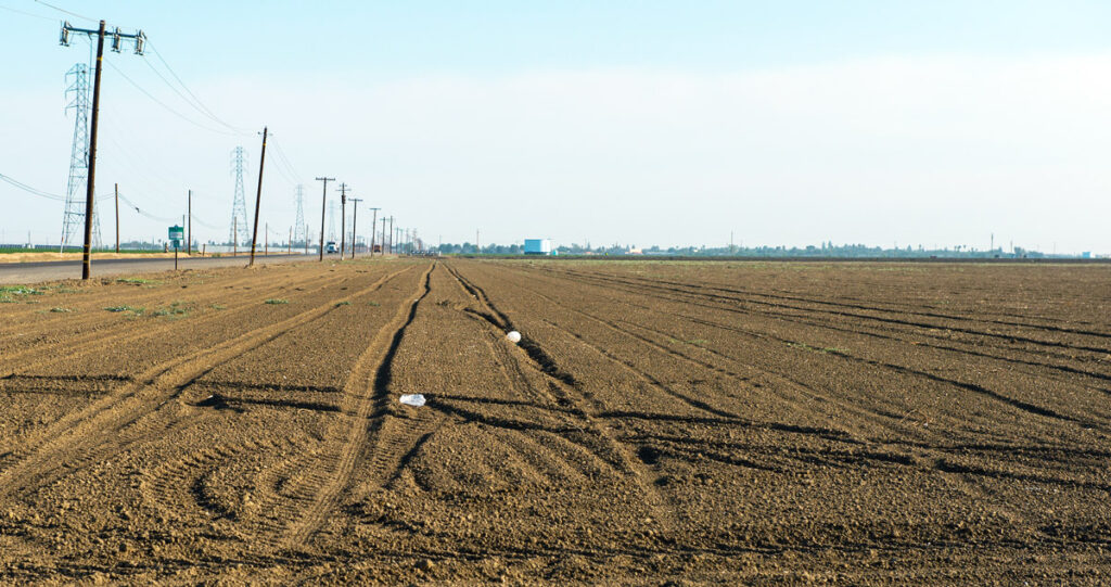
An estimated 500,000 acres or more of the valley’s 4.5 million acres of irrigated cropland must be fallowed.
The economic hit the lower Central Valley is taking can be measured by the declining real-estate values. Doug Phillips, a realtor at the major real-estate firm Schuil, said that “overall, there’s been a 50 percent or more decrease in value.”
“For Sale” signs are blooming in Pixley now, said Jim Morehead, the pistachio farmer. “There’s signs everywhere, and nothing is selling,” he said. “Why would you buy a losing proposition in an area that doesn’t have any water?” The farmer Vincent Sola evokes the generation-old, Valley-wide anger at the 1990s decision to divert some river water to help wildlife and struggling fish populations. “You realize why we’re in this problem? Our surface water has been taken away from us gradually since 1992 … ” he said.
Both Sola and Morehead agree that, if they could wind the clock back, they would prefer the decision to enforce groundwater sustainability had come decades earlier. Said Morehead, “The state failed us back 20 years ago” by waiting to act. Now, “subsidence has pushed that 2040 deadline up to now. Instead of a 25-year plan, it’s a five-year plan. And we’re in year six.”
In the past, Sola said, “we had opportunities to do the same things we’re doing today. We didn’t. It’s human nature – you don’t stop until someone makes you stop…. [but] I wish we could have adjusted a long time ago because pain [would] not be felt as dramatically.”
Is there more acceptance of demand management? “I think so,” said one veteran observer of farm country. “There’s no choice. People are going to comply to the best of their ability. They may go broke.”
An estimated 500,000 acres or more of the valley’s 4.5 million acres of irrigated cropland must be fallowed. Who will fallow, and where, will be influenced by local sustainability plans. If these are deemed inadequate, the state will enforce fees and penalties. Inevitably, some farming will be unaffordable.
Several farmers blame decades of state and federal decisions for provoking the crisis. “A lot of problems come from the government not being responsible for the consequences” of its decisions, said David Evans, a farmer with extensive orchards in the Porterville area near the Friant-Kern Canal.
Details on new plans must be filled in by the new small sustainability agencies. “Changes are afoot again,” Evans wrote in a separate email. “Change and uncertainty does not bode well for permanent-crop agriculture.“
What would Gosselin and DWR do differently?” “Other than that I wish SGMA was in place a couple of decades earlier?” With more time, he said, his office could have had a greater chance to judge how local agencies approached subsidence. “Subsidence was an area we knew we needed more focus on – but we didn’t know that till we reviewed the plans.”
And the impact of the cutbacks on the farmers and the regional economy? Gosselin said, “I have spoken to many many growers throughout the state. Some have had loans called in by lending institutions. [The predicted] loss of half a million acres of agricultural land has already started. … It is heart-wrenching.”

Edited by Geoff McGhee.
In search of water, farmers undermined the San Joaquin Valley. Can collective effort raise their fields, canals – and prospects?
Intensifying groundwater pumping is warping the earth’s surface and wreaking havoc with built infrastructure – including the canals that bring irrigation water.

‘We need to plan for a more water-resilient future:’ Q&A with Richard G. Luthy, urban water expert
Professor Luthy’s work focuses on ways to ensure that water overflows in both urban and rural California can be captured and stored underground. He spoke with & the West about the measures the state needs to consider to protect its water supplies into an uncertain future.

Efforts to preserve California’s groundwater enter a new phase: a season of judgement
Architects of the 2014 Sustainable Groundwater Management Act tried to forestall conflict between state regulators and local groundwater users. But judging plans “inadequate” creates hard-to-reconcile differences.
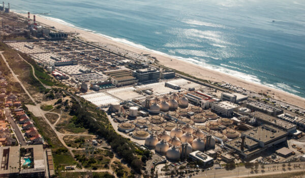
In times of scarcity, California’s best new source of water? Reuse.
While expensive solutions like new reservoirs and seawater desalination grab attention, California communities are quietly building up their capacity to clean stormwater and wastewater for reuse for irrigation, industry and, yes, drinking water too.
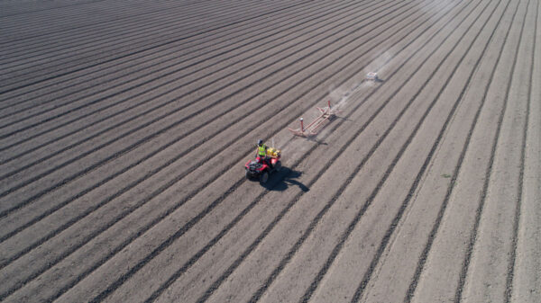
A simmering revolt against groundwater cutbacks in California
New agencies find making sustainability plans is hard, but easier than persuading growers to accept them.

California Water on the Market: Q&A with Barton “Buzz” Thompson
Three months after the first market trades of California water futures, a conversation about economic forces and an essential material for life.

Small Farmers Wait for California’s Groundwater Hammer to Fall
Farmers, large and small, are beginning to grapple with what the Sustainable Groundwater Management Act means for them. Many expect to see cutbacks on pumping once the program is fully implemented in 2040.

Putting a Tempest into a Teapot: Can California Better Use Winter Storms to Refill its Aquifers?
With new rules coming into effect, farmers and municipalities using groundwater must either find more water to support the aquifers or take cropland out of use. To ease the pain, engineers are looking to harness an unconventional and unwieldy source of water: the torrential storms that sometimes blast across the Pacific Ocean and soak California.

As California’s Groundwater Free-for-All Ends, Gauging What’s Left
New rules and new technology are giving farmers and managers a better look at groundwater supplies.

To Save Crops, Farmers Took Groundwater. Then the Land Sank
Like the topsoil, structures built 40 years ago to contain floodwaters are cracking, too.

To Manage Groundwater, California Must First Get Basin Boundaries Right
A vineyard in Paso Robles. Mattyshack via Flickr By Felicity Barringer A hidden treasure, groundwater has long sustained agriculture through California’s cycles of drought. Decades